- Crisis Response
The Independent: “Super El Niño will hit women the hardest, charity warns: ‘We should be very worried'”
This year's super El Niño will hit women across East and Southern Africa hardest, CARE's Regional Director, East and Southern Africa warned, at a time when aid cuts are already stripping away the health services they depend on.
Read MoreBBC America: CARE’s Catalina Vargas on the impact of the Venezuela earthquakes
Catalina Vargas, Country Director for CARE Colombia and first senior CARE representative to deploy to Venezuela in the immediate aftermath of the earthquakes, spoke to the BBC America about the humanitarian needs of the affected populations.
Read MoreTerremotos en Venezuela: Organizaciones lideradas por mujeres, en alianza con CARE, brindan asistencia humanitaria vita
CARE está apoyando a una red de organizaciones venezolanas lideradas por mujeres en la respuesta a dos terremotos históricos que devastaron la costa norte del país en la noche del 24 de junio, causando miles de personas fallecidas y heridas, dejando una devastación generalizada y profundizando una crisis humanitaria.
Read MoreHelp CARE respond to emergencies.
CARE is there delivering lifesaving aid and defending the lives of families in crisis.
Venezuela earthquakes: Women-led organizations, in partnership with CARE, deliver lifesaving aid
CARE is supporting a network of women-led Venezuelan organizations as they respond to two historic earthquakes that devastated the country's northern coast on the evening of June 24, killing and injuring thousands and leaving widespread destruction and a rapidly growing humanitarian crisis.
Read MorePowerful earthquakes hit Venezuela, exacerbating an already deeply fragile context
Our thoughts are with the people of Venezuela as they face the aftermath of two powerful earthquakes that struck the country on June 24, on the eve of a national holiday when many families were gathered in their homes.
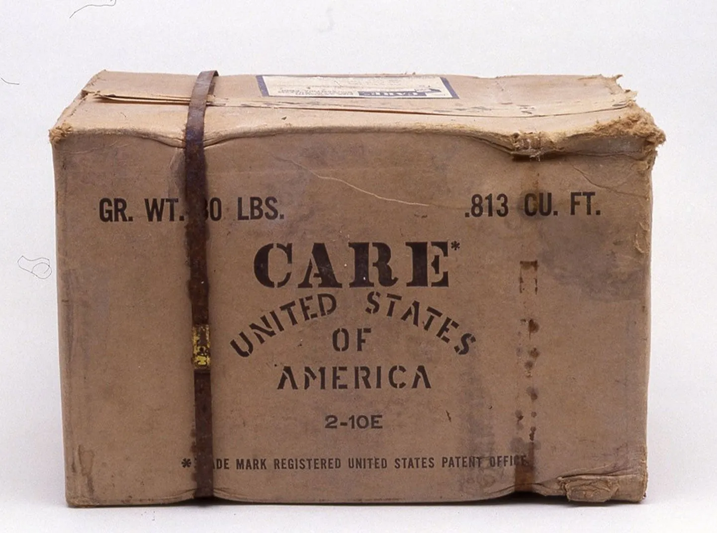
Read MoreThe Philadelphia Inquirer: Eighty years of CARE, an oped by Michelle Nunn
Michelle Nunn, President and CEO of CARE, pens an insightful opinion piece on the significance of CARE's 80 years of compassionate action. It all started with a small box of essential supplies sent from the city of Philadelphia to European families who had survived World War II.
Read MoreJournalists are free to use material from CARE.org without permission. Please tag us on social media and be sure to include proper credit for photos and videos.
For press inquiries, view our Press Resources page or contact us at usa.media@care.org.